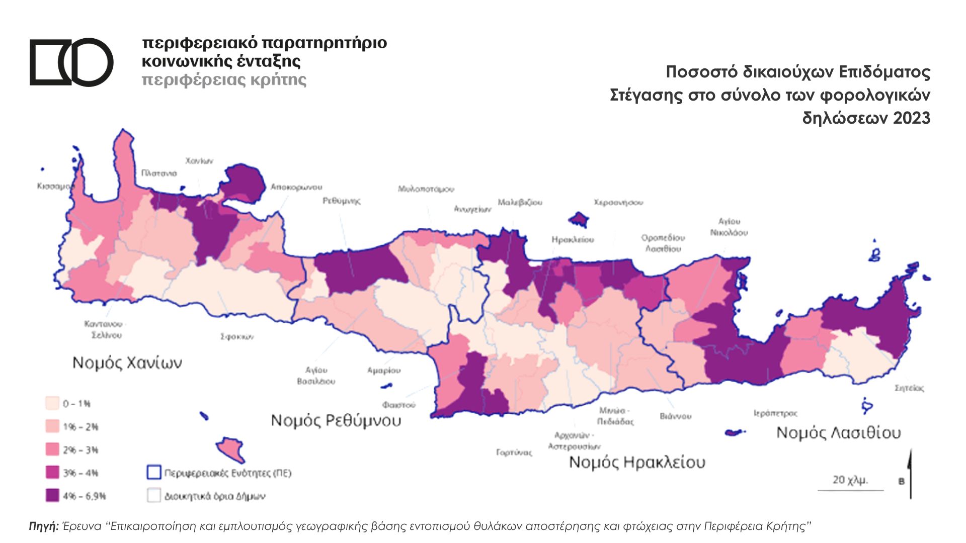
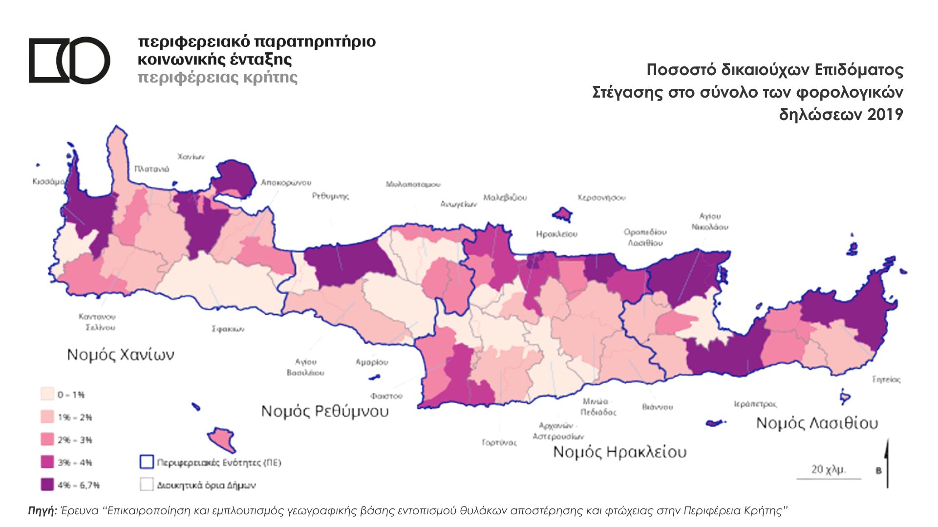
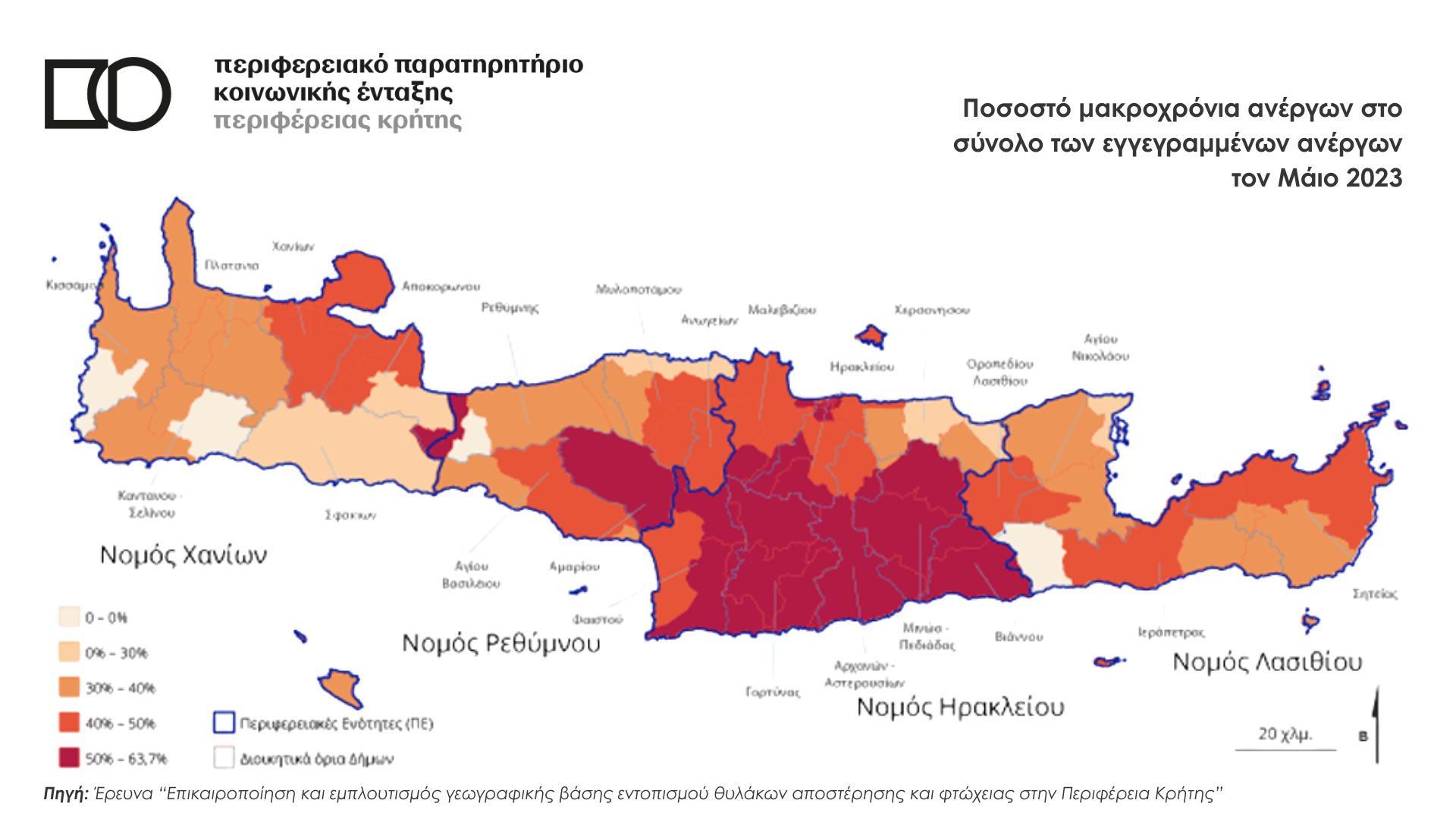
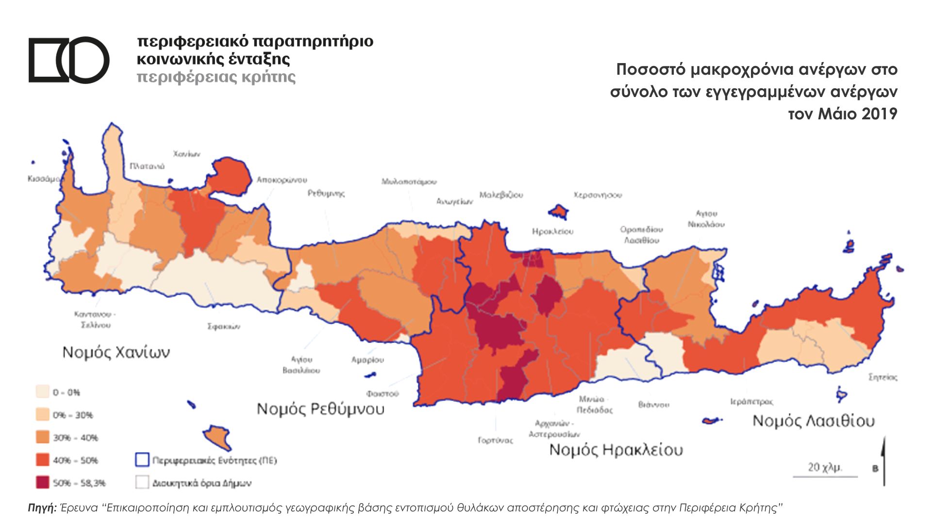
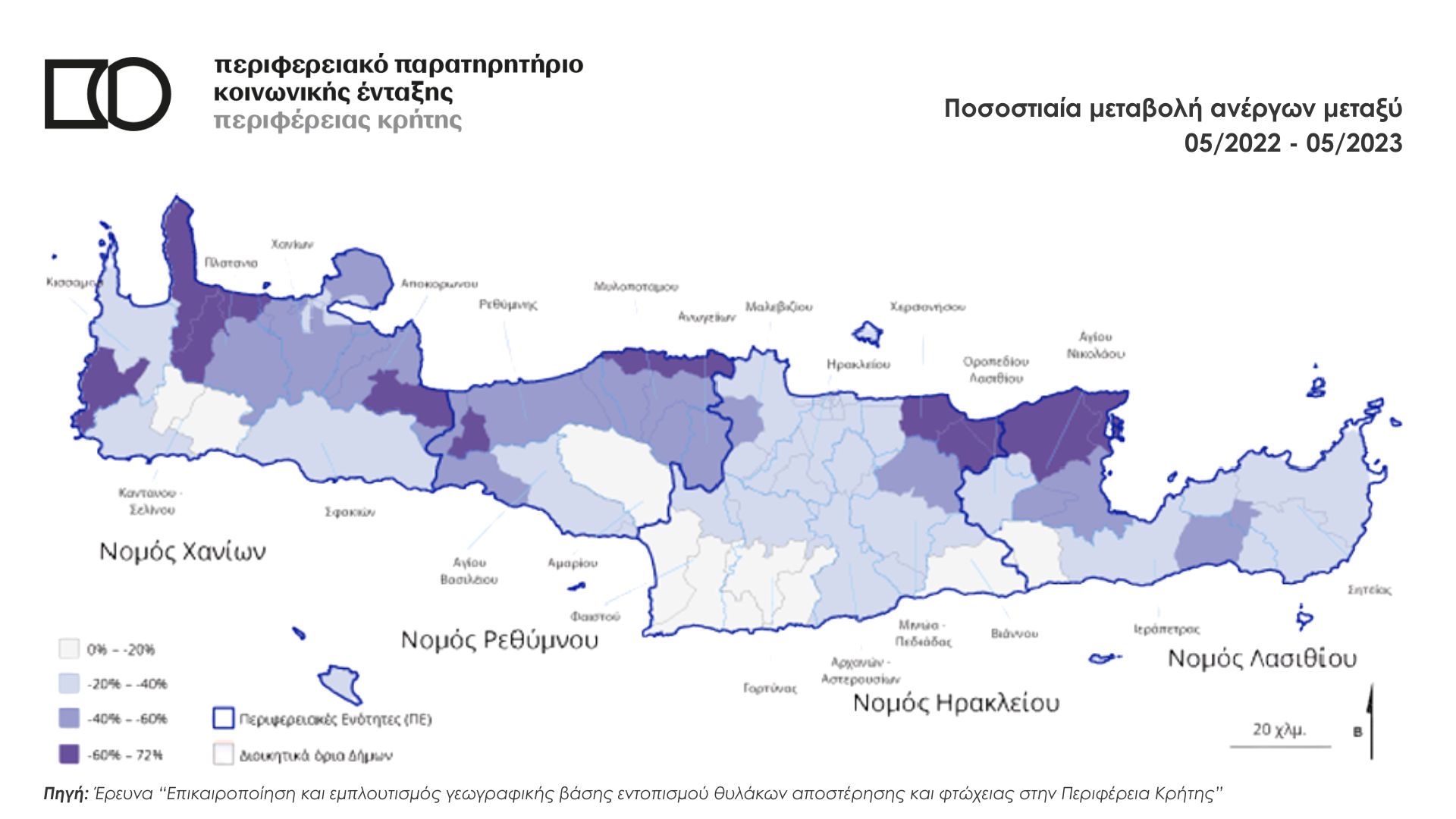
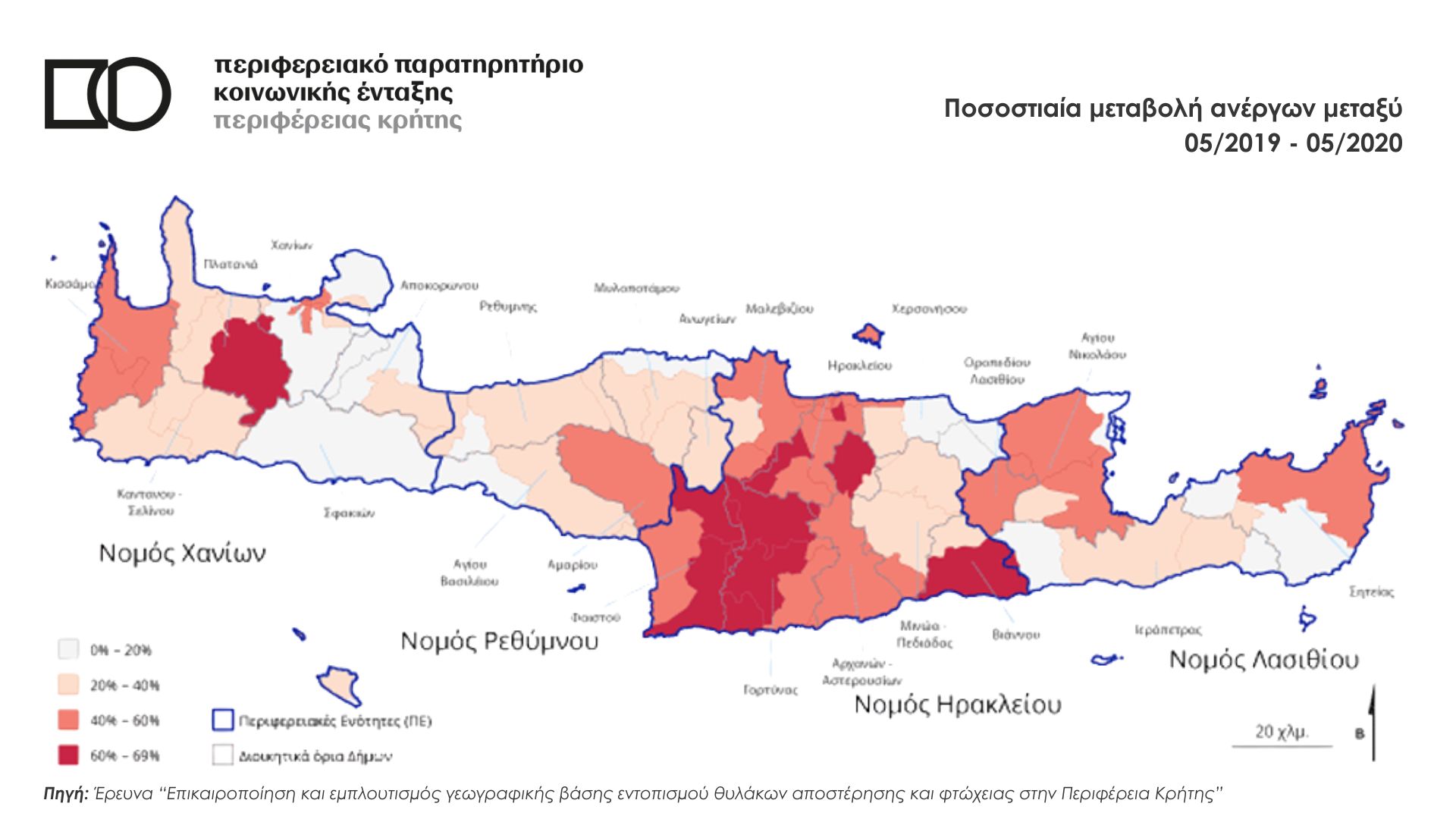
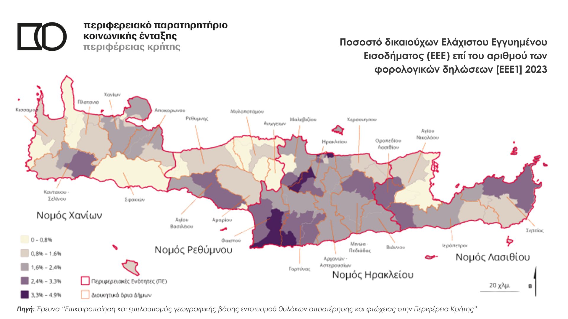
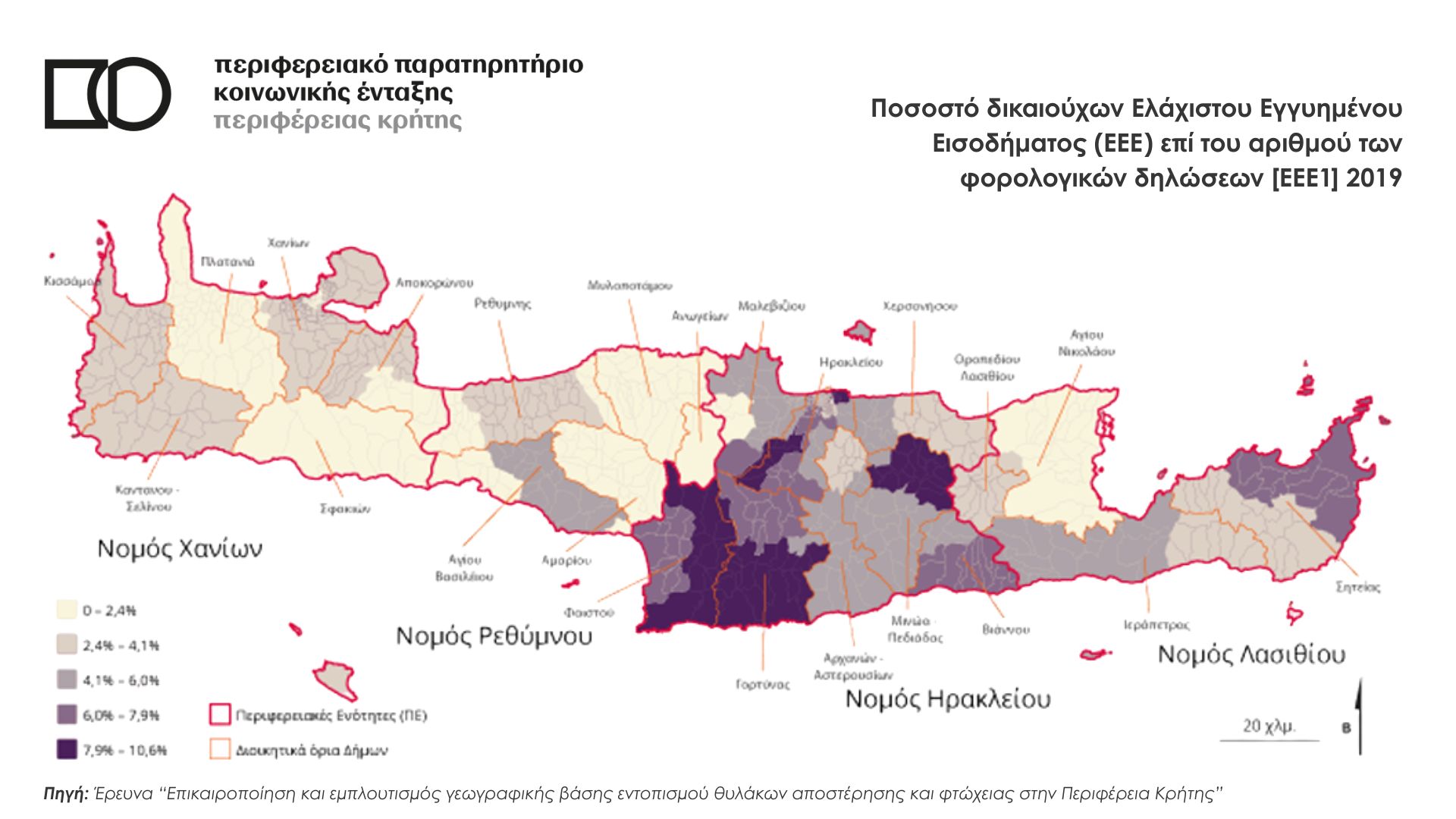
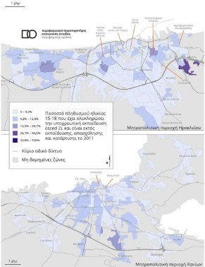
The “deprivation maps” are part of the research work of the University of Crete team, which was prepared for the Observatory, for the periods 2020-2023, within the framework of the 3rd Research Axis “Identification & Analysis of Local Deprivation and Poverty in Crete” and 2025-2028, within the framework of the 2nd Research Axis “Updating and Enrichment of the Geographical Base for the Identification of Deprivation and Poverty Pockets in the Region of Crete”.
For more information regarding the maps and local deprivation in Crete, you can refer to Section Research I.
The indicators and pockets of local deprivation have also been captured in interactive maps in the Geographic Information System of the Region of Crete (GIS Crete) which are available upon request & only through the Observatory.